Our Favorite Hikes in Washington State

Summer in this region of the Pacific Northwest is home to cascading mountains, lush forests, vibrant wild flowers, moody mornings, and stunning alpine lakes. We just barely scratched the surface of our list of trails to complete in our time here, but the hikes I am sharing with you below are absolutely worth adding to your itinerary if you are exploring Washington any time soon — especially in the warmer months.
Planning our Hikes:
Finding Trails: Washington Trails Association is such a great resource to utilize when you are searching and preparing for hikes in Washington State. We like to compare statistics and reviews from this site to those of AllTrails to get a good idea of the most recent conditions. We always download a trail map on the AllTrails app to refer to during the hike.
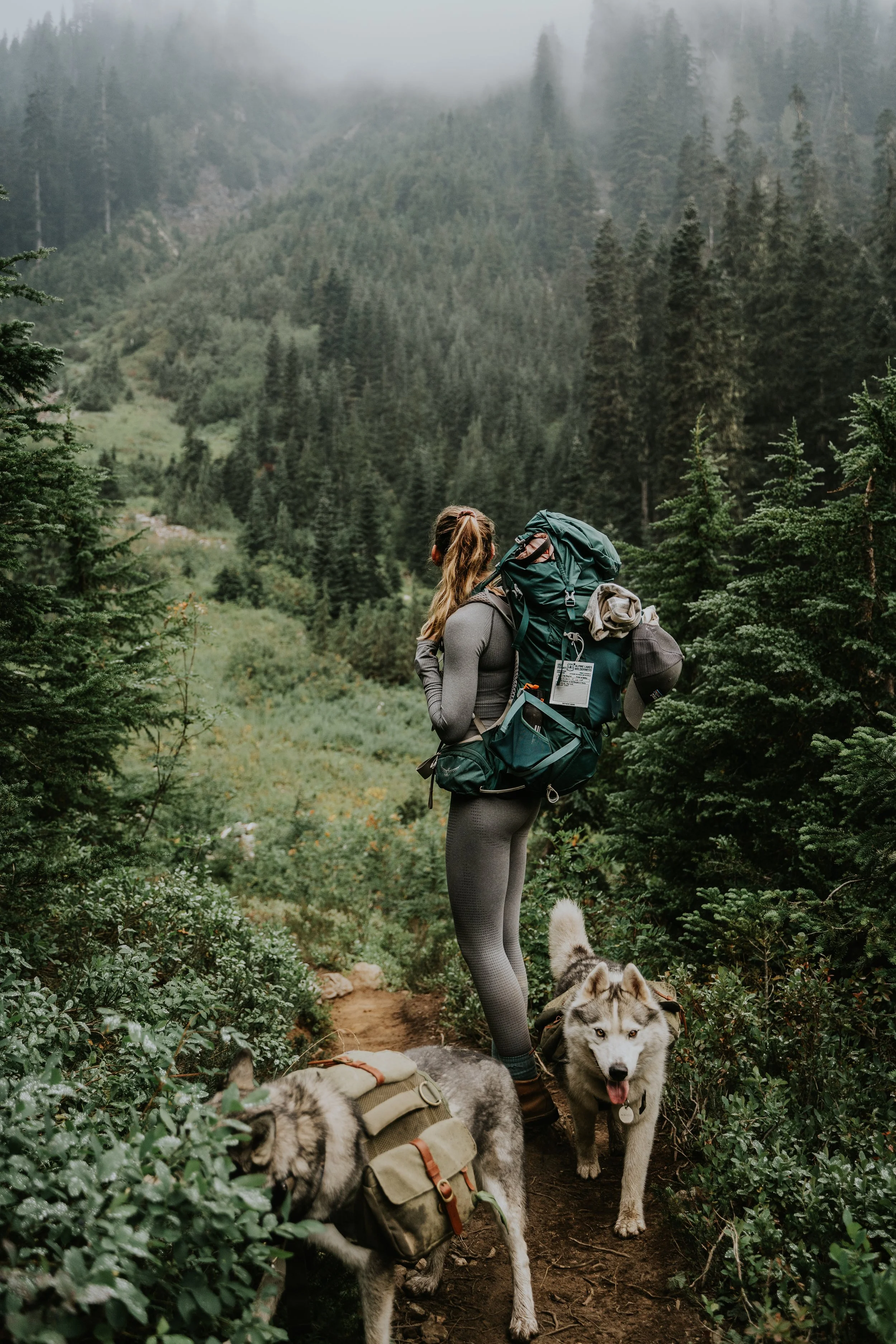
Packing for the trail: Take into account the time of year and always pack emergency supplies. We leave extra water and snacks in the car, as well as an emergency blanket. My on-the-trail staples for summer hiking includes:
Backpack and rain fly
Water bladder and snacks
Headlamp, inReach mini, lighter, utility knife, first aid kit, sunscreen, bug spray, bear spray, Suunto GPS watch
Clothes: water resistant shell, puffer jacket, mid layer, long sleeve base layer, hat, extra socks
Preparing the trailhead: Buy seasonal passes ahead of time and always keep them in your car. The Northwest Forest Pass will allow you access into any national forests. The National Park Pass will gives hikers access to the national forests as well as the national parks (this is basically a two for one and definitely will save you money if you plan on visiting any combination of national parks at least three times a year from the date the pass was purchased). Lastly the Discover Pass is used for entry to all state parks. Every single trail we hiked required one of the above passes.
Yellow Aster Butte Trail
Difficulty: Moderate
Mileage: 7.5 miles out and back
Elevation Gain: 2,550 ft
Pass Required: Northwest Forest Pass
Accessibility: The dirt road to get to this trail has a few points where you may need to take turns if passing traffic. Overall, high clearance is nice to have but not necessary unless you plan to drive past the trailhead. 4WD is not needed in dry conditions. Parking is limited at this trailhead and it is a popular trail so I would recommend an early start — especially if you plan to hike on a weekday in peak hiking season. If parking at the trailhead is full, there are a few spots above and below the trailhead you may park in if you have the right vehicle and don’t mind the additional mileage.

We opted not to do this trail the first time we were in the area because we thought we might end up with the same exact views, but dang were we wrong. The colors on this trail were as incredible as the views. After climbing the switchbacks through the forest, the tree line breaks and mount baker is staring straight at you. We picked blueberries as we traversed through the meadow and they were so tasty and refreshing. From the vantage point of the butte you can see there are a ton of established areas for backpackers to stake their claim; be sure not to place your tent on any vegetation as it is a super fragile ecosystem. If you do plan to backpack, you may opt to leave your pack at the bottom of the butte to return to after soaking up the panoramic mountain view. This trail definitely gets crowded during the summer and there is no shade once you break through to the meadow, so it is one that is best done early in the day, for a sunset hike, or later in the season. Chair 9 Pizza and Bar is a great place to stop for some post-hike food and a drink — the atmosphere is laid back and you’re bound to run into like-minded, outdoorsy people.


Marmot Lake and Jade Lake
Difficulty: Hard
Mileage: 21 miles out and back
Elevation Gain: 4,500 ft
Pass Required: Northwest Forest Pass
Accessibility: Getting here was very easy as the final 12+ miles from the trailhead are on a maintained dirt road. Of note, when we went in September 2022 a lot of the previously established sites at Jade Lake are under a restoration process. Please respect the off limit boundaries set by our national forest services so we can continue to explore these beautiful places.

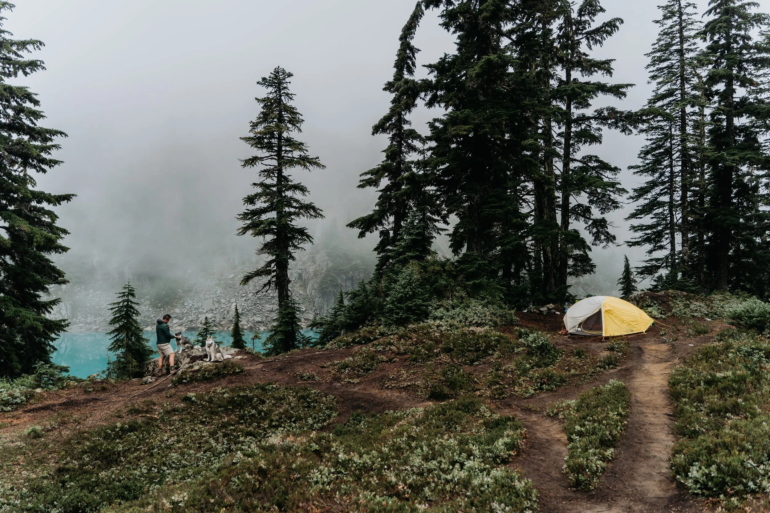
This was the longest trail we completed in Washington, and we had a blast. We started our approach at Tucquala Meadows. From this trailhead, the hike is relatively flat until you reach the first lake which sits a few miles in. You’ll pass in and out of mossy forests and open meadows along the way. There were two sections of steeper incline we encountered before reaching the final push from Marmot to Jade. This last stretch involves a bit of a scramble through boulder fields with cairns indicating the best route. While this trail can definitely be completed as a day hike, it is also very common for people to camp at Marmot or Jade. We picked a designated site up near Jade lake, but due to the weather conditions most of our views were obstructed by fog. The little glimmers of Jade Lake we did see through the pockets of rolling fog made the entire trip more than worth it. We initially had plans to continue along the trail after setting up camp to explore pea soup lake, but we didn’t feel the extra mileage would be worth it with the visibility being so limited. We only shared the lake with two other sets of campers but this is a very popular trail to complete on a beautiful summer day.


Winchester Mountain Trail
Difficulty: Easy/Moderate
Mileage: 3.4 miles out and back
Elevation Gain: 1,300 ft
Pass Required: Northwest Forest Pass
Accessibility: This is the roughest road we drove on in Washington although I still don’t think it really compares to some of the roads in Colorado. It definitely does require high clearance and I would highly recommend 4WD. We didn’t need to engage our 4WD but any amount of mud or snow would probably cause some issues. It is very rocky and fairly steep as it snakes its way up the mountain side with tight switchbacks, making the road one lane at certain points in time. There is parking at the Yellow Aster Butte trailhead which would add about 2.5 miles onto your hike each way if you have a low clearance car and would still like to complete this hike!

This trail was such high reward for such low mileage — it was sheer beauty from parking lot to summit. Even the road to get to the trailhead is a sight to see once you’ve broken above the trees. We completed this trail as a sunset hike and were blown away by the show the sky put on for us. Winchester Mountain is a very well maintained trail that starts at twin lakes and winds up through a meadow littered with evergreen trees. The incline is fairly steady and moderately steep until the final 400ft push where the grade increases. The fire tower overnight system is a first come first serve basis, available to the public for overnight stays.
Since having done this trail, I have felt that it is the most frequently photographed trail I have seen on instagram of all the trails we completed. And I honestly never get tired of seeing other’s perspectives because the views are simply iconic. As you gain elevation from the trailhead, you’ll notice you have an unobstructed view of twin lakes which are backdropped by beautiful, jagged peaks. As you round the corner, Mount Baker comes into view and the wildflowers surrounding the trail really start to pop off. Continue around the curve and the jarring image of Mount Larrabee might just leave you speechless. Larrabee is a red tinged peak juxtaposed against beautiful layers of PNW greens and sprinklings of crisp snow as pictured above. Even though this is a heavily trafficked trail and the most difficult to access of all the trails we hiked, it is the trail I would recommend most highly.


Hidden Lake Lookout
Difficulty: Hard
Mileage: 8.0 miles out and back
Elevation Gain: 3,300 ft
Pass Required: Northwest Forest Pass
Accessibility: The road to the trailhead is steep, rocky, rutted and narrow. Make sure to take it slow and pass carefully.

This trail was nothing short of incredible, but for the full story and to see more photos, come back to see my blog about sleeping in a fire tower when it goes live!
Blanca Lake
Difficulty: Hard
Mileage: 7.5 miles out and back
Elevation Gain: 3,300 ft
Pass Required: Northwest Forest Pass
Accessibility: This trailhead was very easy for any car to access. In the summer of 2022, camping within a mile of the lake was prohibited due to a restoration project.

In all honesty, this trail was probably Niko’s least favorite Washington hike. We opted to backpack it not realizing until we got to the trailhead that there was a restoration project prohibiting any camping within a mile radius of Blanca Lake. The trail was steep and we started our trek during the hottest hour of the day — oops. Most of the incline was tree covered which offered a good amount of shade, but the heat and incline was a little rough to be packing an overnight bag. We made it to the meadows and found a nice designated spot to prop up our tent before the final mile which is a rocky, root covered descent to the lake. I carried my pack down to the lake so we could enjoy our dinner down there, and so I could change out of my swimsuit for the hike back up. The lake is stunning. The level of excitement I had when I caught my first glimpse through the pines was unreal. It is the most turquoise and milky (yet so clear) water I had ever seen. The lake had only a handful of other people enjoying the last few hours of sun so there was plenty of space to explore a bit and take a dip. Be careful when swimming in this lake — there are so many downed trees that could easily create an unsafe situation, especially if you are set on jumping in. The mosquitos were brutal so we we clambered right in to our tent when after making our way back out of the lake’s basin. We had a pretty early start in the morning to make our way back to our car. I have to admit that even I thought the trail really dragged while lugging all of our stuff back down. Even if there were no restrictions on where to camp, I don’t know that I would ever choose to backpack this trail again but I would definitely return for a day trip!


Park Butte Lookout Trail
Difficulty: Moderate
Mileage: 7.5 miles out and back
Elevation Gain: 2,200 ft
Pass Required: Northwest Forest Pass
Accessibility: The final 9 miles to the trailhead are on a dirt road. This road was wide so passing opposing traffic was no problem. There were minimal pot holes or rocks of concern and we saw cars of all sorts in the parking lot.

This is a super popular trailhead as it leads to many beautiful destinations, including access to mount baker. We went for an overnight hoping to score the lookout tower which is available on a first come first serve basis. The trail starts off in a sparse forest that grows in density as you hike until it begins to wind uphill with switchbacks through a tall, wooded forest. Continuing on there will be a bridged creek crossing, a boulder field, and reportedly beautiful meadows. We went very early on in the season so there was full snow coverage from the time we broke out of full tree coverage until we reached the fire tower. Snow can definitely make a hike more challenging but the trade off was having a low crowd setting — this fire tower is usually buzzing with day hikers and backpackers whereas we only encountered two other couples. Unfortunately the tower was already occupied by the time we arrived, but we were able to find an established site relatively nearby that happened to be free of snow. The views of baker from park butte are so stunning because of the proximity, and the panoramic views make the effort more than worth your time. We would love to go back and explore this trail later in the summer season once the snow has cleared.


Summit Lake Trail
Difficulty: Moderate
Mileage: 6.2 miles out and back
Elevation Gain: 1,420 ft
Pass Required: Northwest Forest Pass
Accessibility: The last 6.5 miles to the trailhead are on a dirt road that was moderately rocky and bumpy. It was very narrow in spots due to overgrown brush. Many people recommend a high clearance, 4WD vehicle to access this trailhead. We did not need to utilize our 4WD at all but as the season goes on, or if the road becomes very wet or snowy I could see how a 4WD would be a necessity. Please know your car’s limits, your skill level, and check out most recent condition reports should you plan to do this hike!

The trail to Summit Lake was well maintained and easy to follow. The majority of the hike winds through a coniferous forest until you break through to a meadow surrounding the lake. We went in mid June and there was still quite a bit of snow toward the end of the trail which created some very soggy conditions on the way up from snowmelt. The lake itself lake was partially frozen but we could still see the beautiful, deep colors. There is a ridge line that you can climb to get a gorgeous panoramic viewpoint with glimpses of Mount Rainier. This last stretch of the footpath can be completed as a loop if you’d like. It is narrow and steep but well worth the effort. Since the trail falls outside of the boundaries of Mount Rainier National Park, it is one of the best spots to see this beautiful volcano while enjoying time with your pup in the backcountry. If seeing Rainier is a bucket list item for you, be sure to take the forecasted visibility and cloud coverage into account. We went on a partially cloudy day and got some really good moments where Rainier and the moon were peaking through. This would be a great trail to backpack if you are looking for a low mileage backcountry night, and for us it was a perfect sunset hike. Cell phone service was very limited on route to this trailhead so make sure your directions are loaded and your trail map is downloaded!


Of note, maple pass loop was a super beautiful trail we completed but didn’t include on this list simply because we didn’t take any photos on this trail. We opted to be more intentionally present on this hike and soak it all in just for ourselves. If there are any trails you think we should do next time we visit Washington or want to share how much you love one of the above trails, feel free to leave a comment below!